
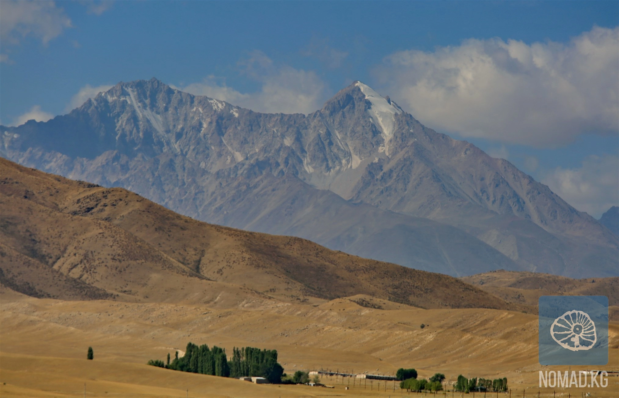
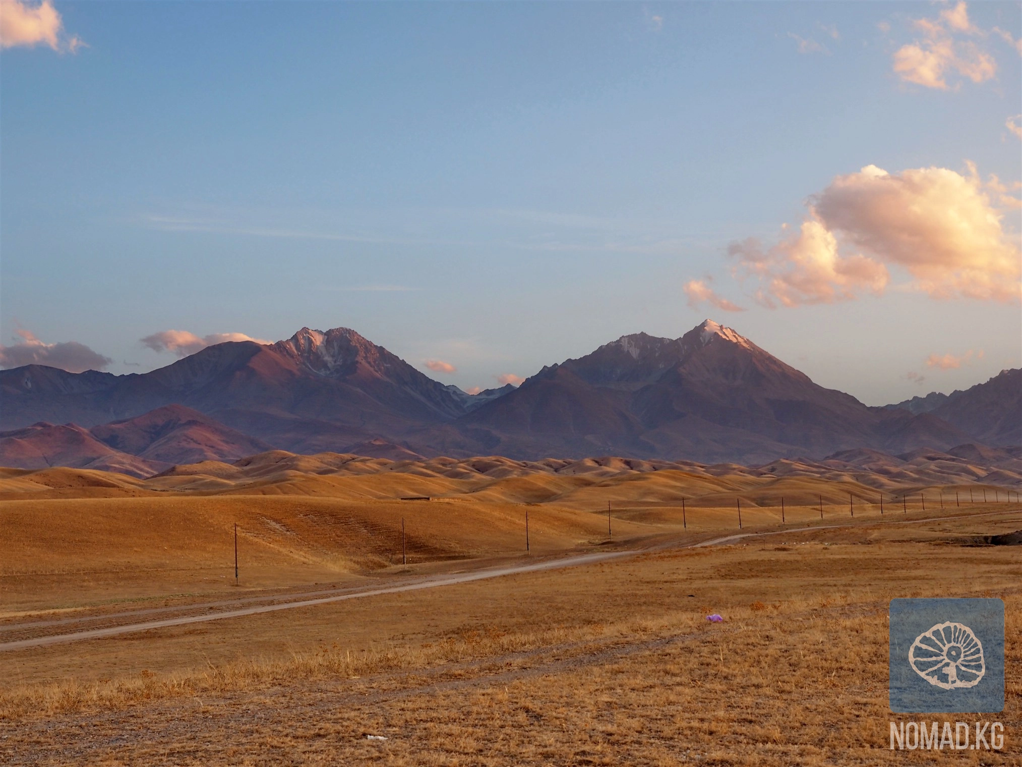
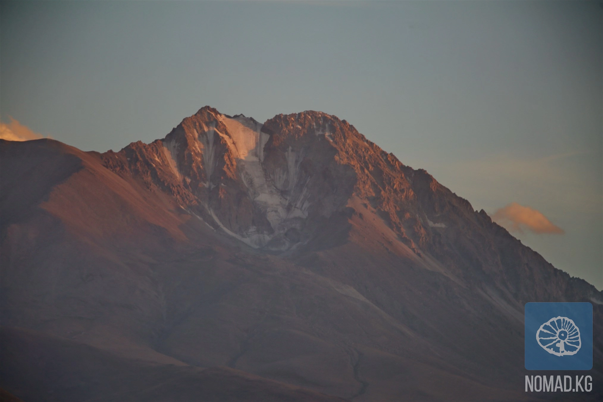
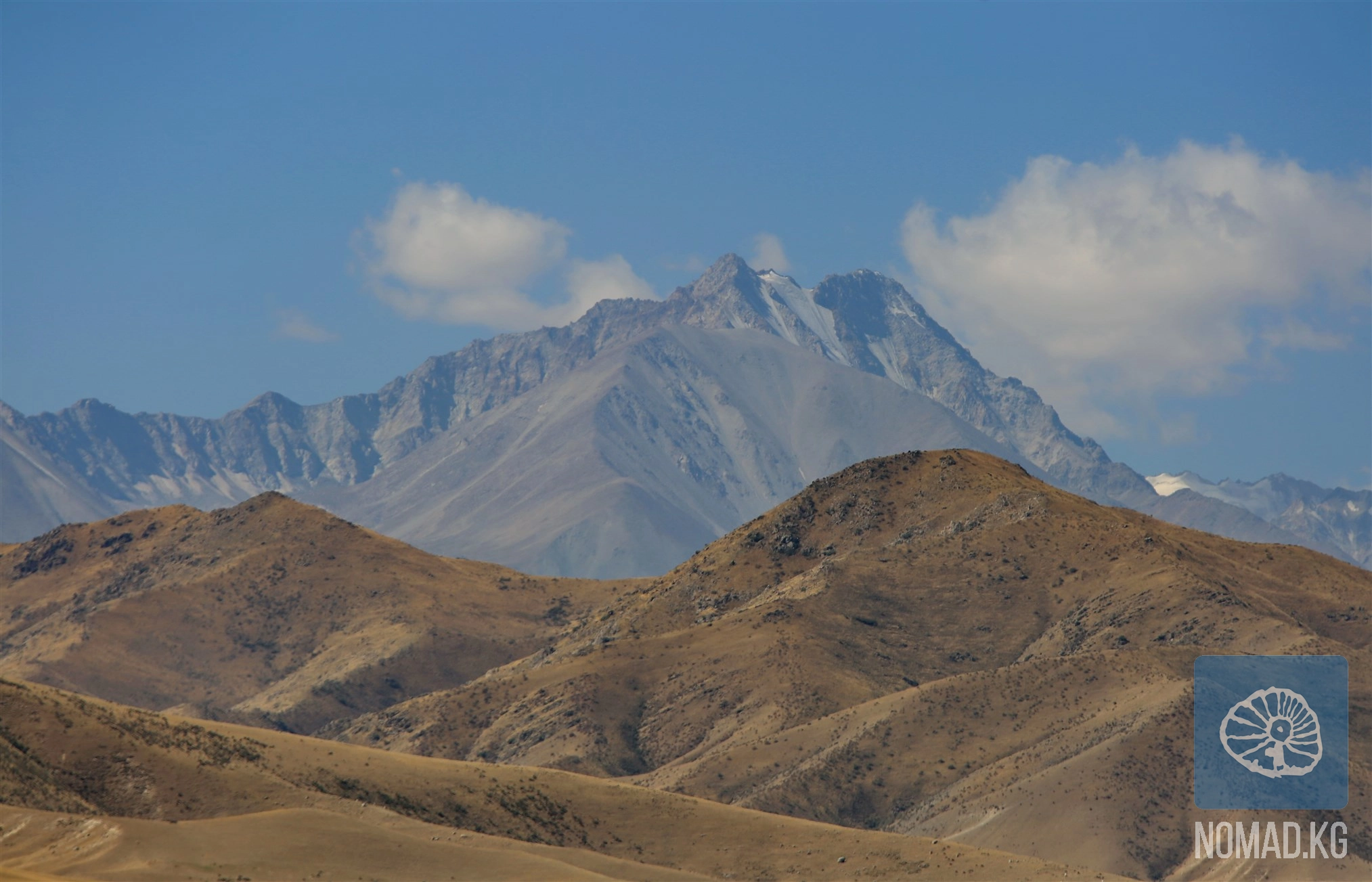
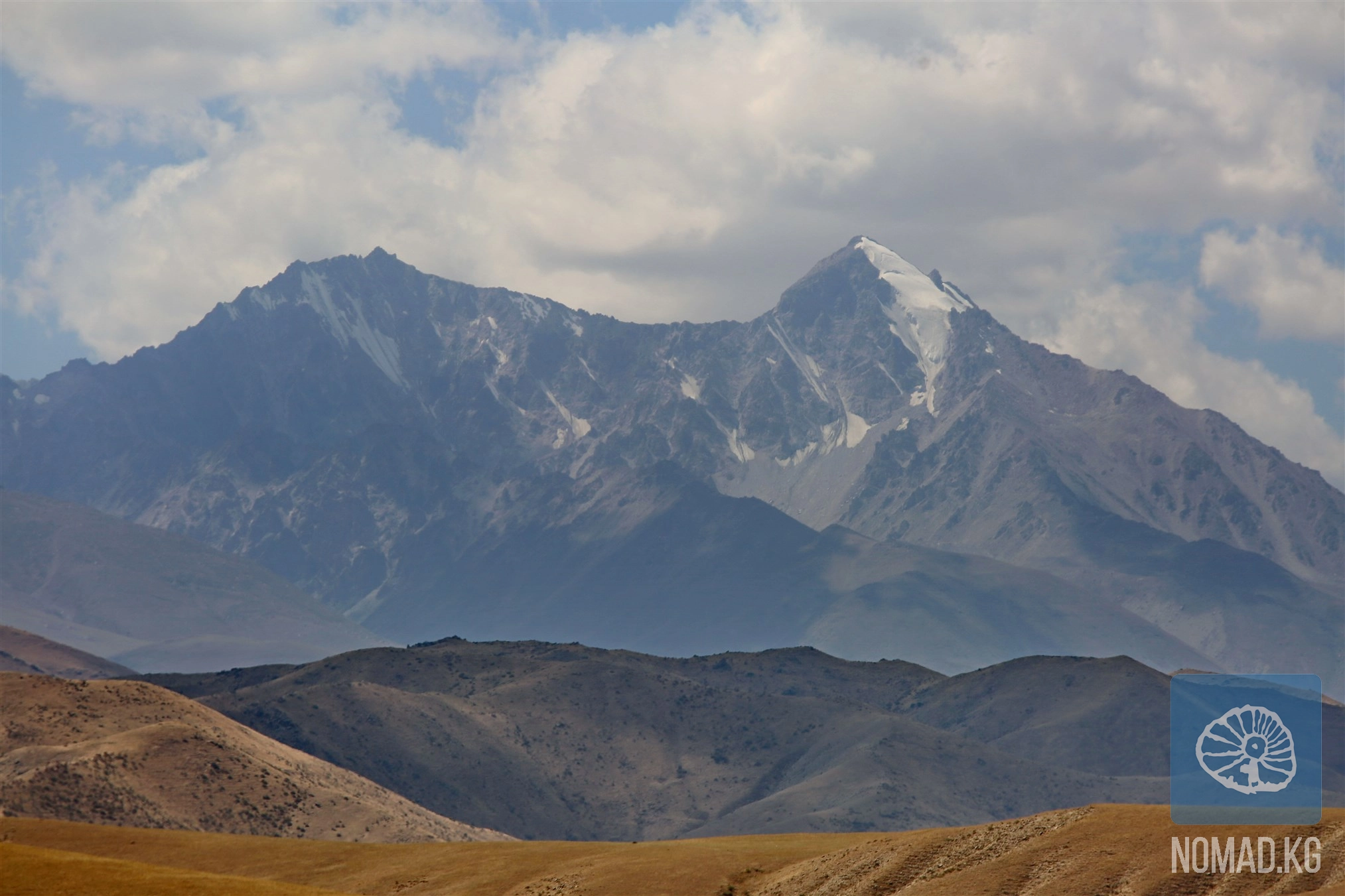
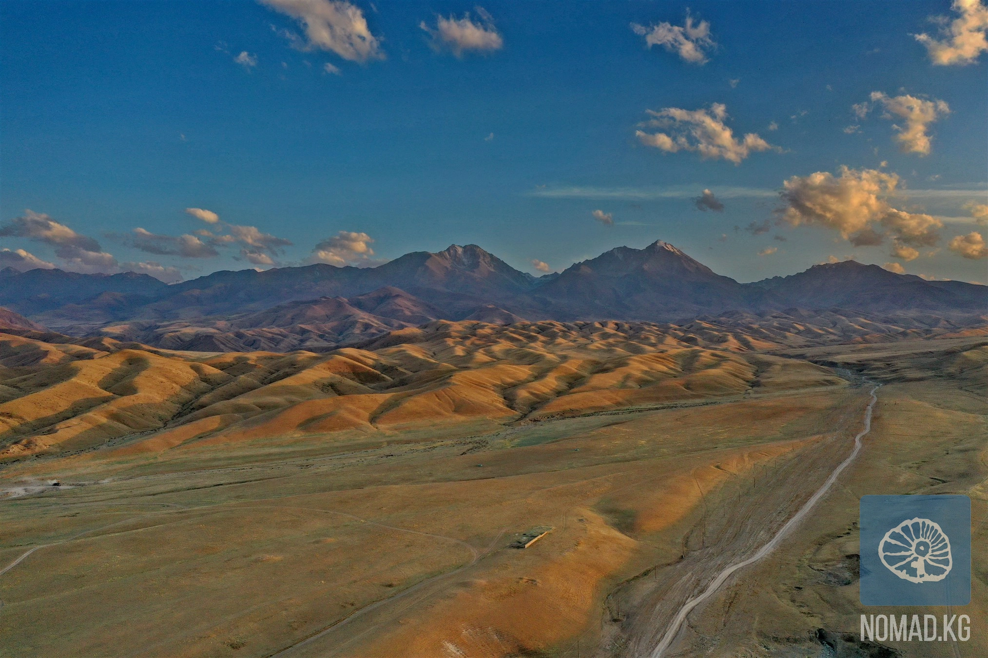
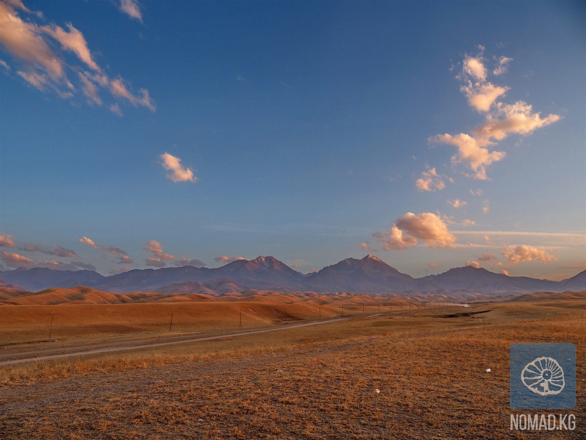
Peak Manas is the highest point of the Talas Ala-Too ridge, with an elevation of about 4485-4488 meters above sea level, and this figure alone sets the tone: here, the familiar routes end, and the territory of true mountains begins. The high-altitude zone of the Talas Ala-Too has a distinctly alpine character. Narrow ridges, sharp peaks, rocky walls, and steep slopes, reaching 60-70 degrees in places, form a harsh, almost ascetic landscape. On such inclines, snow and ice do not linger for long—the wind and sun quickly expose the dark stone. The northern spurs descending into the Talas valley gradually soften: the rocks give way to grassy slopes, intersected by a network of ravines. Here, one can feel the transition from the world of height to the world of nomadism—from stone to grass, from ice to pastures.
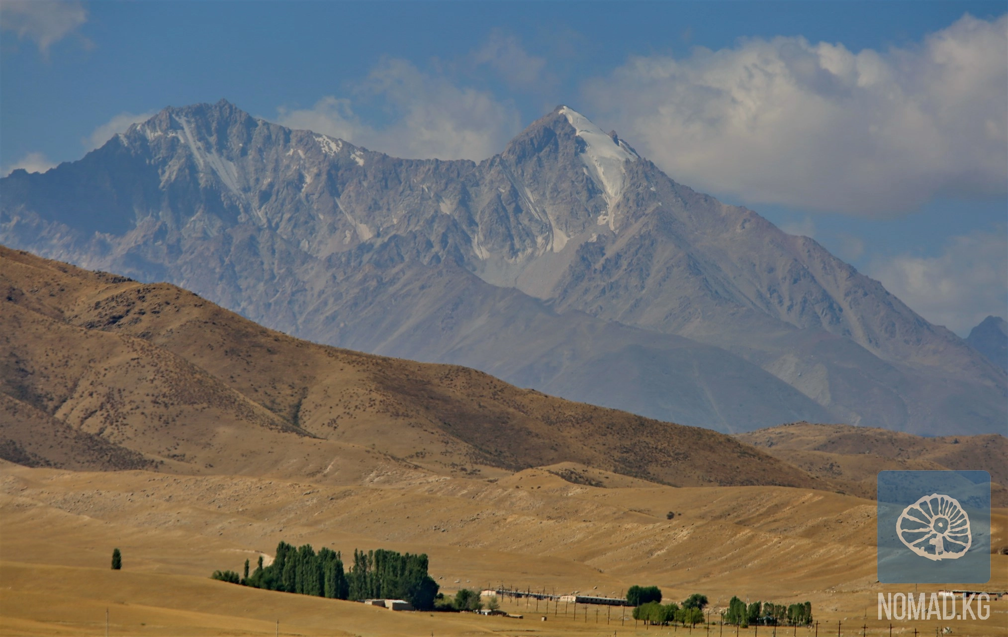
Peak Manas is located in the central part of the glacier on the northern slope of the western part of the ridge, in the Kara-Buurin district of the Talas region. To the west of the summit lies the Manas Glacier—a compact yet expressive glacier, about 850 meters long, with a characteristic bend in its central part. From here, a ridge extends northward for about 400 meters, behind which an extensive cirque opens up, culminating in the North Manas Glacier. Its tongue gradually transitions into a powerful moraine extending up to three kilometers, from which tributaries of the Arabek River originate. The geography here is not just a backdrop; it is a living system where every crack and every stream extends far beyond the visible.
Particular significance is given to the place by the fact that the ridge passing through Peak Manas becomes the state border between Kyrgyzstan and Uzbekistan about 1.8 kilometers later. In these areas, the concept of a border is felt not as a line on a map but as a natural watershed, familiar to nomads long before the emergence of states.
The name of the peak, "Manas," sounds especially fitting here. In oral tradition, it is believed that such mountains receive names not by chance: they either preserve the trace of a hero or correspond to his character. Harsh, powerful, standing out among the other peaks of the Talas ridge, the peak seems to embody the epic scale of Manas—the warrior, unifier, wanderer. From a scientific perspective, the history of the name is recorded in 1937, when members of an alpine group working within the framework of Professor A. A. Letavet's Tian Shan expedition made the first ascent. At the suggestion of one of the participants, Vladimir Ratsek, the peak was named "Manas." But for the local inhabitants, this name sounded familiar long before the advent of climbing reports.
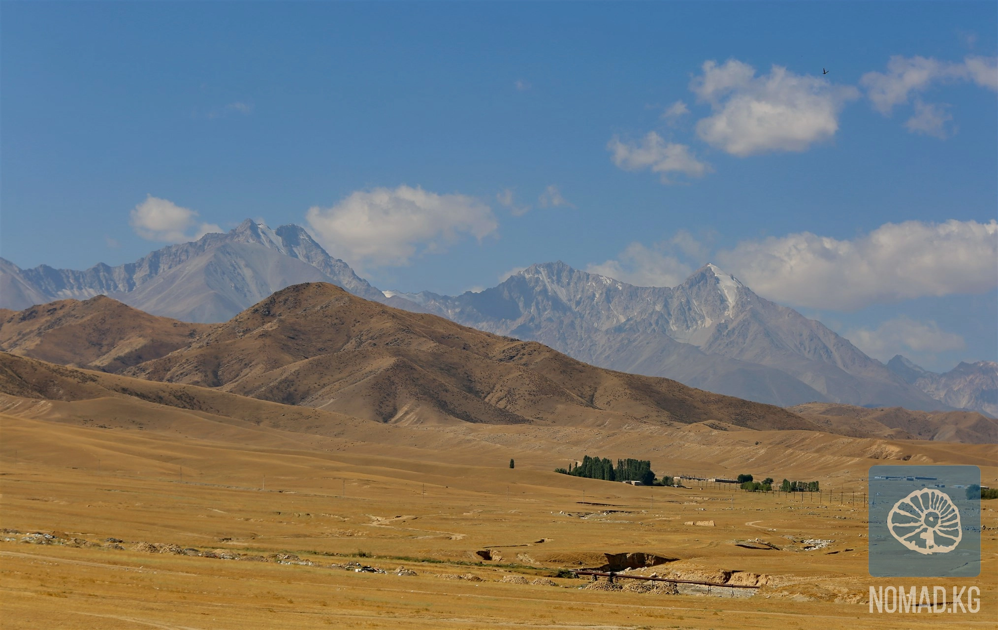
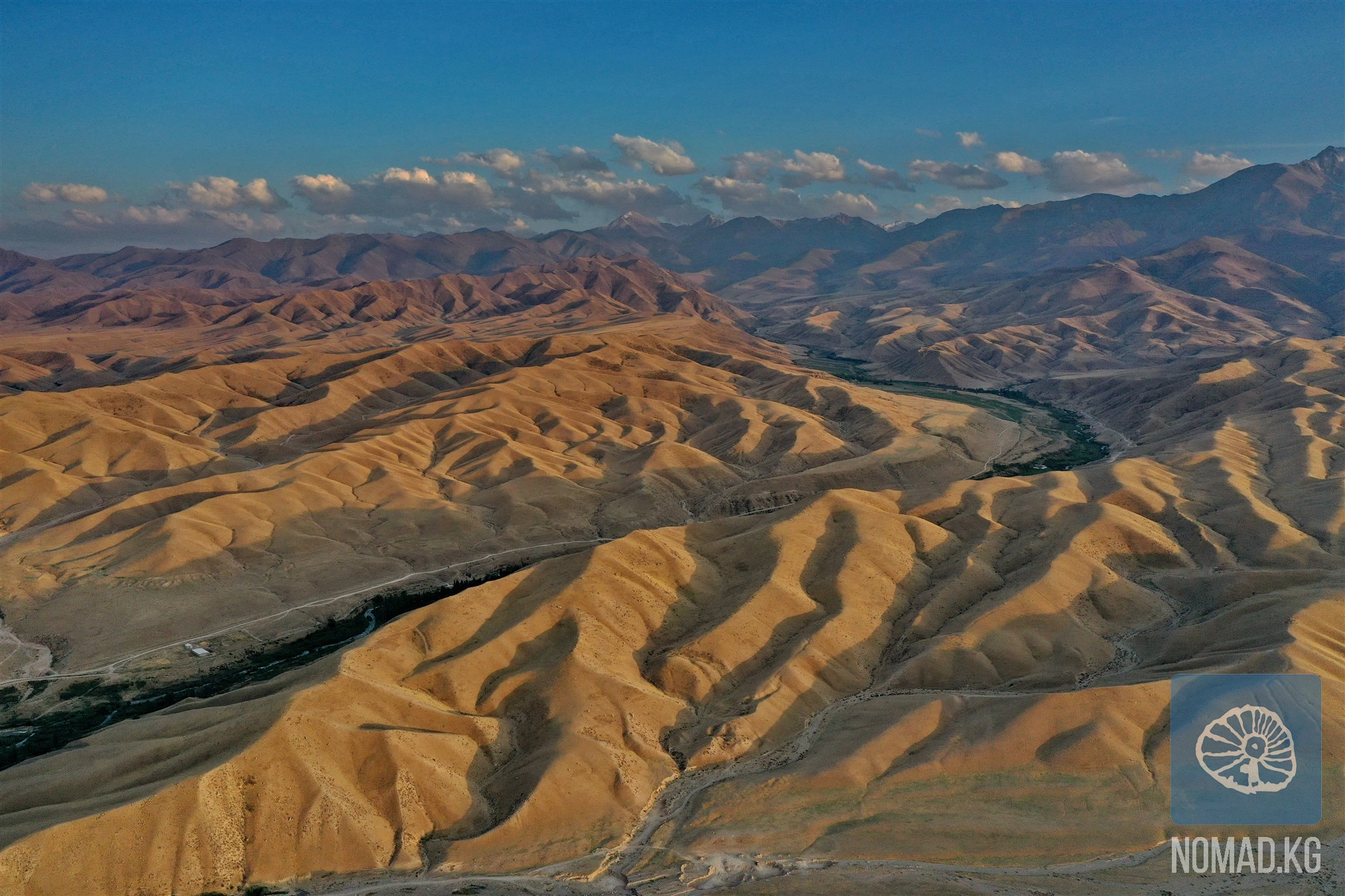
Peak Manas rarely becomes the goal of a "one-day" trip. Even if you do not plan to climb, the approach to the massif is already an experience. Valleys alternating with altitude belts, silence broken only by the wind and the shouts of shepherds driving cattle up the slopes of the mountains, create a feeling of a gradual entry into another space. Here, it is important not to rush. Strolling along the northern spurs, observing how the light changes on the slopes throughout the day—all of this is part of the journey no less than the summit itself.
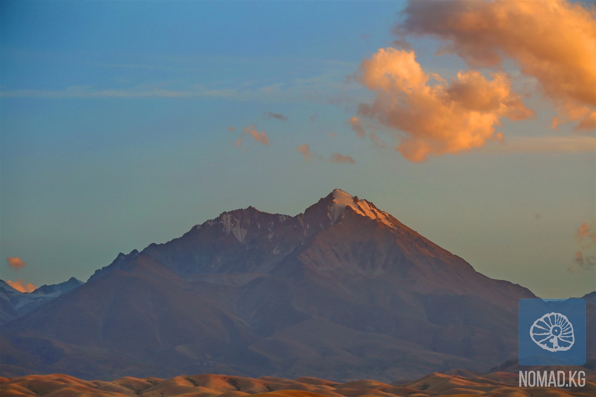
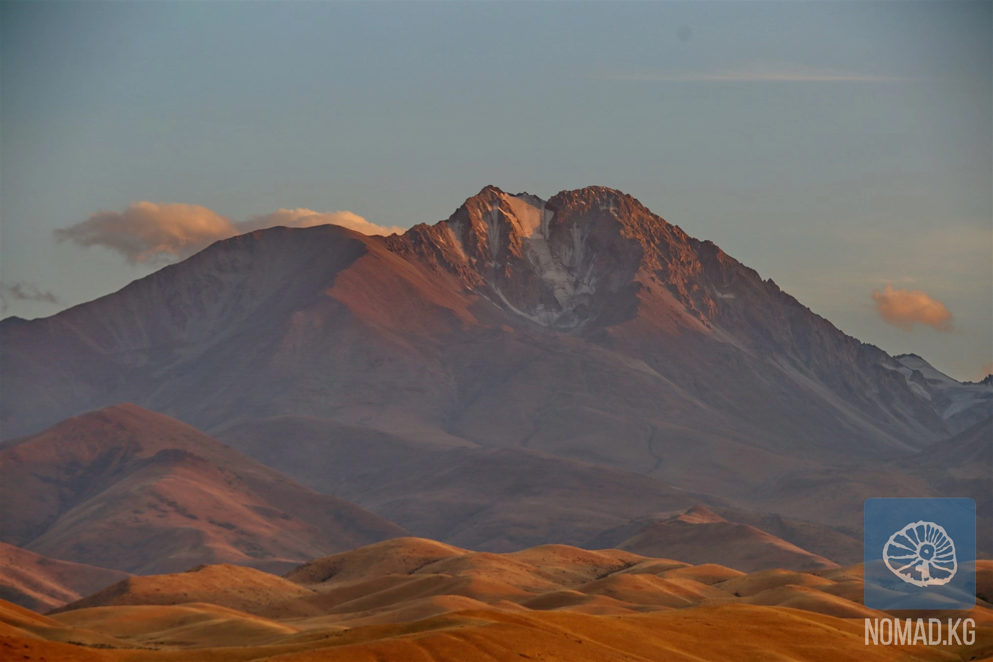
The morning hours are the best time for observations. At this time, the glaciers reflect cold light, and the ridges look particularly graphic. Closer to noon, the stone heats up, and the mountain changes color, shifting from gray-blue to warm ochre tones. Photographers appreciate these places for the pure geometry of lines and the absence of visual noise. There is no excess here—only form, light, and space. In the lower zones, you may encounter shepherds driving cattle between seasonal pastures. Their way of life is simple and functional, but it is in such encounters that the living nomadic culture is best felt—without decorations and reconstructions. Sometimes a conversation starts with the weather and ends with a story about how the mountain "shows character" or how important it is to respect the place where you are.
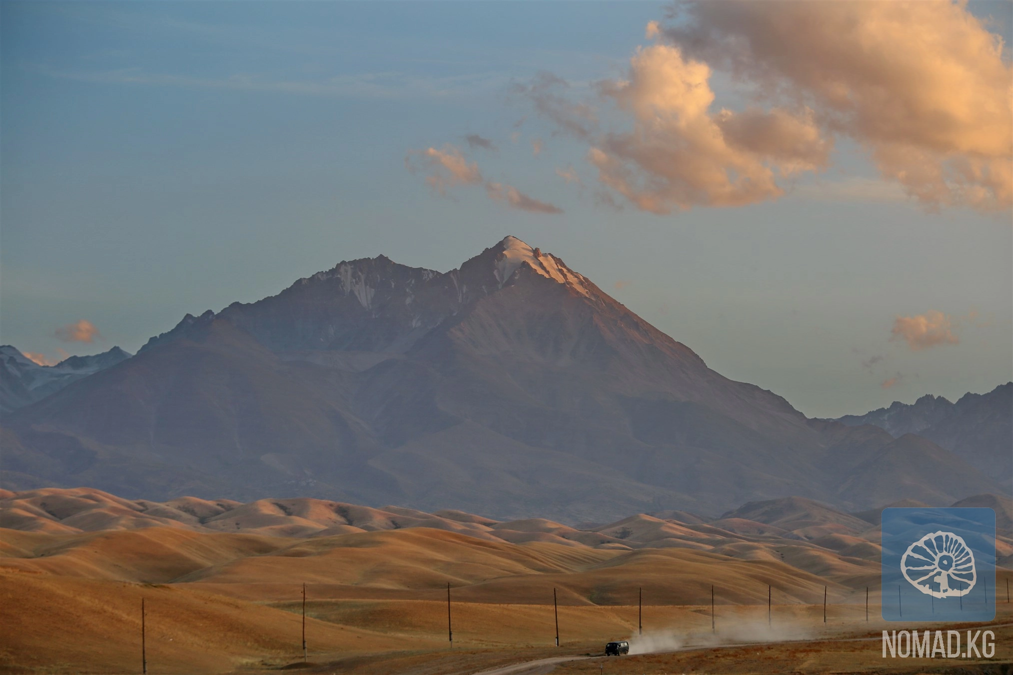
The base point for ascending the peak is usually the city of Talas, from where you can drive towards the Kara-Buurin district. The further route depends on the chosen path and the time of year: some roads are accessible only by all-terrain vehicles, while the final sections require a hike. Public transport will only take you to the settlements in the valley; beyond that, it’s either hitchhiking or a pre-arranged transfer.
The optimal season is from late May to early September. During this time, the passes are relatively stable, and the weather is predictable. Even in summer, nights at altitude are cold, and the weather can change within an hour.
Even for simple routes, warm clothing, protection from wind and sun, and a sufficient water supply are necessary. For those planning to go higher, basic mountaineering gear and experience in high-altitude conditions are mandatory.
In the valleys, overnight stays in yurts or with shepherds can be arranged. In the high mountains—tents. Comfort here is conditional, but that is part of the experience.
Altitude, sharp weather changes, lack of mobile communication, and unmarked trails require independence and responsibility. This place is not about getting a "checkmark," but about a conscious journey.
Peak Manas and its surroundings are a vulnerable ecosystem. Everything you brought with you must go back. Respect for nature and people here is not an abstract principle but a necessary condition of the journey.
Peak Manas is not just the highest point of the ridge. It is a place where time slows down, and the scale of everyday concerns shrinks to the size of the trail beneath your feet. Here, you particularly understand that nomadism is not just a way of life but a way of perceiving the world: movement without haste, respect for space, readiness to be a guest.
Leaving here, you may not take with you bright souvenirs or loud stories. But there will remain a feeling—as if the earth allowed you to walk alongside it for a moment and look in the same direction. And that is enough for the journey to continue.
Among the picturesque mountains of the Bakai-Ata district, not far from the village of Urmaral, lies one of the most mysterious and revered places in the Talas region - the Kara-Koyun cave. This is not just a dark niche in the rocky mass, but a
If there is a place in the Talas region that amazes from the very first step, it is the Talas Birch Grove - the largest man-made birch forest in all of Central Asia and one of those places where humans and nature have created a true oasis of
If you have already seen Lake Besh-Tash and think that the national park has revealed all its secrets to you, then you simply haven't yet ascended the Itagar Pass. This is the route after which photos remain in your phone's memory that you
Kyrgyzstan is a country where the memory of ancestors, sacred space, and natural power merge into a single cultural landscape. For centuries, Kyrgyz people have placed special importance on burial monuments and holy sites—mazars. Even today,
The Besh-Tash National Park, which translates to "Five Stones," stretches in a narrow chain along the Talas Ala-Too mountain range. On a good gravel serpentine road up the Besh-Tash river gorge, it feels like the car is about to hit the
In the Talas Valley, among the hills and green valleys, lies one of the most revered sacred places in the region - the mazar of Boo-Terek. Its name translates from Kyrgyz as "a bundle of poplars" or "many poplars," and this is no
High in the Kaman-Suu gorge, at an altitude of about 2500 meters above sea level, lies one of the most expressive and multilayered monuments of rock art in Kyrgyzstan - Jaltyrak-Tash, which translates to "shining stone." This is not just a
The Talas Valley is one of those places where Central Asia speaks to the traveler through the language of wind and silent stones. Here, between hills and gorges, traces of ancient civilizations have been preserved, whose names have long dissolved in
In the very heart of the blessed Talas Valley, where the silvery Talas River leisurely carves its path between two majestic mountain ranges - the Talas and Kyrgyz ranges - lies a unique natural oasis. The Talas Forest is not just a green stripe on
The Ötmäk Pass (3326 m above sea level) is one of the most impressive places in the Talas region and an essential mountain artery connecting the closed Talas Basin with the expansive Suusamyr Valley and the strategic Bishkek-Osh highway. This is the
The Talas region is one of the corners of Kyrgyzstan where history is felt not in museum showcases or academic works, but in the wind, in the scent of dry wormwood, in the lines of mountains frozen around the valley like an ancient choir. Here, the
The Besh-Tash Nature Park covers over 30,000 hectares, stretching nearly 30 kilometers upstream along the river of the same name - from the gentle foothills at an altitude of 1,100 meters to the harsh, cold glaciers rising to 3,500 meters. The park
In the Talas Valley, there is a place where legends come alive at every step, and the silence of the mountains speaks louder than any storyteller. This is the Besh-Tash Gorge - one of the most picturesque and symbolic natural spaces in Kyrgyzstan.
The mountains of the Talas Ridge conceal many secrets, but one of the most astonishing is the complex of rock carvings at Bakayir-Kara-Kuush, located in an easily accessible gorge where human footsteps are lost among the stones, and ancient
In the center of the village of Kyzyl-Adyr, which many travelers remember by its old name Kirovka, there is a local history museum named after Mikhail Fyodorovich Tura in the secondary school named after Orozbekov Meilibek. At first glance, it seems
In the very heart of the picturesque Talas region, amidst the rugged gorges of the Bakai-Ata district, lies one of the most unusual natural wonders of Kyrgyzstan - the "Kara-Kishi" geopark. This place seems to exist outside of time: the
Among the hills of the Talas Valley, near the clear river Ken-Kol, lies one of the most cherished places in the vicinity of the National Complex "Manas Ordo" - the sacred spring "Kanykey Apa." For the Kyrgyz, this is not just a
Where once small rural streets stretched along the river valley, where people lived a measured steppe life, today lies a vast expanse of water - the Kirov Reservoir, one of the most significant hydraulic structures in Kyrgyzstan and an impressive
The Talas Geopark "Echkilі-Tuu" is located in the mountain range of the same name, Echkilі-Tuu, which is part of the Kyrgyz Ala-Too ridge, in the Sary-Kuurai gorge, one of the most impressive natural attractions of Kyrgyzstan. This geopark
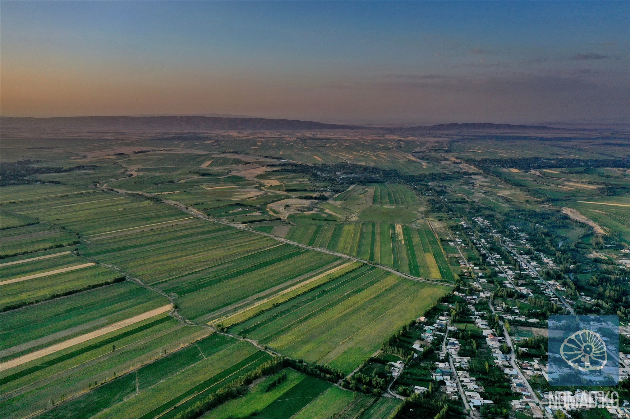
Today, beans have become a true brand of the region. More than 70% of all exported beans from Kyrgyzstan are grown right here, in the fertile Talas Valley. The locals respectfully refer to it as "white gold" - and not without reason. It
Usually, the discovery of archaeological sites is associated with hard-to-reach mountains, abandoned trails, or deep gorges that are accessible only to researchers. But the Talas region surprises once again: not far from a busy road, just a few
In the narrow stone corridor of the Chon-Kapka gorge, where the road seems to glide between sheer cliffs, a traveler is suddenly confronted by a massive concrete wall of a dam. But what strikes one the most is not the engineering itself, but the art
On the strategic route from Bishkek to Osh, at the turning point towards the road leading to the Otmak Pass (3332 m) and further into the Talas region, lies one of the most recognizable places along the entire route - the so-called "Gates of
Just thirty minutes by car and ten minutes on foot from Talas lies an amazing place - the Kulaan-Sai mine, one of the most accessible old workings for lead ore extraction in the region. At first glance, an ordinary mountain gorge, Kulaan-Sai